|
|
| Day 1. Edale to The Snake Pass. 28 October 2006 |
| | |
|
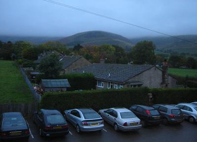
At dawn the weather isn't ideal for our first day's walking:
clear views from the
Ramblers Inn in Edale, but a few hundred feet higher the cloud is
sitting low on Kinder Scout. Still, it's quite warm, and it's not actaully
raining. We drive both cars to the end of the walk and leave one there.
On the way back we stop off for sandwiches in Hope and by 10.30 we're
ready to set off. (10.30 is a compromise. Peter - 'Come on. We could be
half way there now'. Andy - 'What's the rush? We've got all day.')
|
|
|
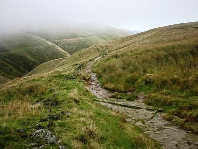
An hour and a half later we reach the top of Jacob's Ladder and leave
the clear skies below us. One of the great joys of walking on high
ground is the view from the top, so of course it's disappointing if the
clouds close in just as the scenery starts to get really good, but
there's something about walking through cloud that goes a long way to
making up for it. You feel so detached from the rest of the world.
|
|
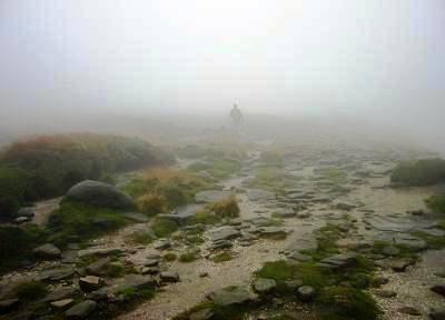
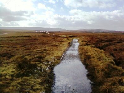
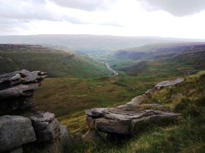
If you're using a GPS there really is no excuse for getting
lost, so we shouldn't be walking across the middle of
Kinder Scout when the route skirts the edge of it. The map shows a
number of paths, but we don't actually find any. The easiest walking
is along the river beds, but at times you have to climb up the steep
peat banks and pick your way through the mixture of heather and bare
black peat. It's too easy to step from solid ground into a deep bog, and
once you're there it's frighteningly difficult to get out. Without
someone to pull you back on to dry land, the more you try to free youself
the deeper you sink.
|
|
|
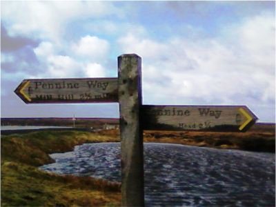
By 3.00 pm we're back on track and nearing the end of the first days walking.
I know, a lot of people would have pressed on to Crowden rather than
calling it a day a the Snake Pass, but we're feeling rather pleased with
ourselves anyway. The last couple of miles is flat, easy walking along a
pathway made of flagstones reclaimed from the Lancashire cotton mills.
In spite of this I'm really running out of steam at this stage and it's
good to hear the muffled sound of traffic on the Snake Pass through the fog.

|
|
| Day 6. The Snake Pass to Crowden. 9 March 2011 |
| | |
|
Back on the Snake Pass five years later. I'm now on the other
side of 50. A new job has taken me to Manchester for a meeting tomorrow
so I've stopped off on the way up to pick up the journey.
|
|
|
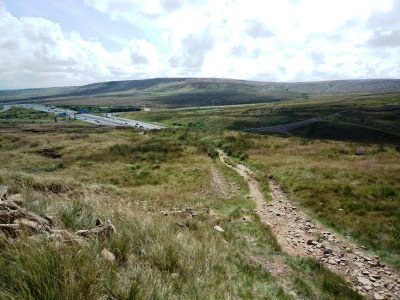
On this part of the Pennine Way you're never far from large centres of population
but it doesn't always seem like it. A fifteen minute taxi drive from a
suburban train station, then 10 minutes of walking, and you feel like the
only person on the planet.
|
|
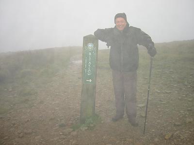
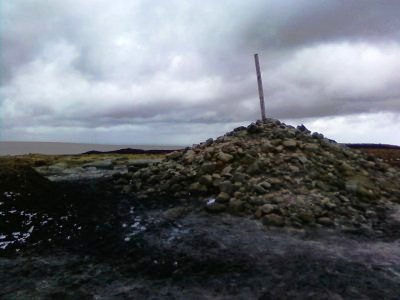
The route down from Bleaklow Head is not that clear. After a short distance
it turns to the west. Unfortunately I carry on going north and end up at
the east end of the Longdendale Trail rather than somewhere in the middle of it.
|
|
|
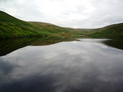
I follow the trail along the banks of the Woodhead and Torside resevoirs to pick
up the last section of my planned route to the A628 Woodhead Pass. At this point
I have to retrace my steps to the Longdendale Trail, then west to Hadfield Station
where I've left the car
|
|
| Day 7. Crowden to Standedge. 3 August 2012 |
| | |
|
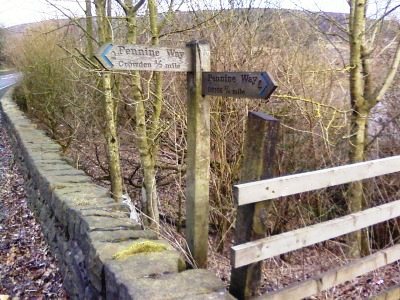
Picking up the journey a year and a half later I'm back in Crowden. It's the
start of 4 days' walking that will, I hope, take me to Gargrave. My wife has dropped me
of on her way to visit friends on Anglsey. As the car pulls away I realise how much I'm
going to miss her. It's the longest we'll have been apart for over 10 years.
For the first few miles the best views are behind you as you climb steadily to Black Hill
|
|
|
Approaching Wessenden Reservoir there's a sudden cloud-burst in an otherwise
rain free day but by the time I get there all is tranquil again. there's a final steep
climb up to Black Moss Reservoir, then I leave the Pennine Way on the A62 to head for the
campsite at The Carriage House. There's still enough light to pitch the tent (a tiny one-man
tent that weighs practically nothing) before enjoying a good meal and three pints of
surprisingly stong organic cider
|
|
| Day 8. Standedge to Hebden Bridge. 4 August 2012 |
| | |
|
It's 15 miles to Hebden Bridge so everything is packed up and I'm away before 9:00.
You're never far from civilisation in this section of the walk - planes flying in to Manchester Airport,
and views over built up areas to the west, then there's the footbridge over the M62
|
|
|
After a quick lunch at the White Horse Inn it's on past Blackstone Edge Reservoir and an easy level
walk to Stoodley Pike before dropping down into the Calder Valley where I leave the Pennine Way
at Callis Bridge to head for my B & B in Hebden Bridge.
|
|
|