|
|
| Day 9. Hebden Bridge to Pondon. 5 August 2012 |
| | |
|
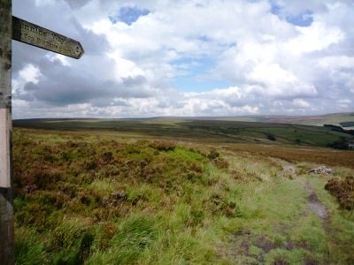
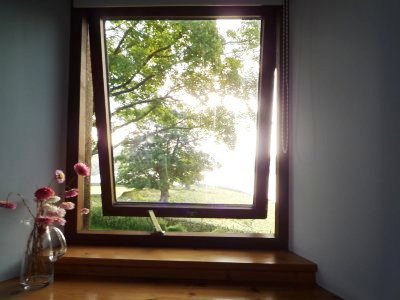
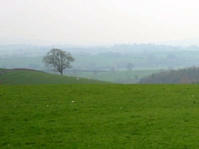
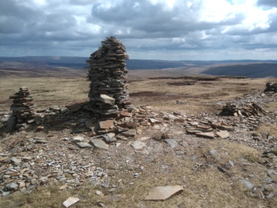
A shorter walk today (just over ten miles) but it starts with two steep climbs out of the
valley to the moors. In contrast to the previous two days there's a real sense of wilderness here.
It's good to walk for mile after mile without seeing any signs of modern life.
of the val
|
|
|
Top Withens as a building is a bit of a disappointment. It's been subjected to a severe conservation.
It might have been kinder to allow it to fall into a more natural state of ruin. It's clear, as a
plaque on the wall says, that it was the location rather than the building that inspired Emily Bronte's
Wuthering Heights. Down the hill to Pondon. I've booked a pitch at the Pondon House campsite,
but rain is threatening, and I decide to opt for the Bed and Breakfast option instead. A very good
meal and excellent Theastons Old Peculiar at the Old Silent Inn.

|
|
| Day 10. Pondon to Gargrave. 6 August 2012 |
| | |
|
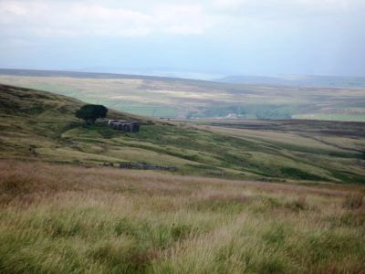
It looks like another good walking day when I wake up, but by the time I've had breakfast
and packed the clouds have covered the sun and it's raining steadily. I need to cover around 17 miles
today and the last train home from Gargrave is at 6:15 this evening. I try not to feel too daunted
as I climb up to the moors.
|
|
|
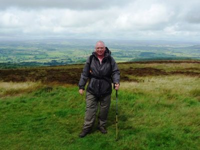
The weather improves gradually through the day and I start to dry out. There are beautiful views
in every direction at Pinhaw Beacon. I loose the way a bit coming down to Thornton-in-Craven, but
soon find a route back - thank goodness for GPS!
|
|
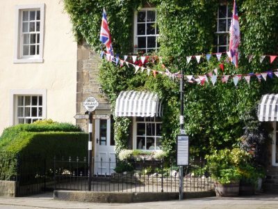
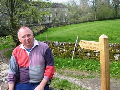
Gargave is a welcome sight after about nine hours walking. It's good to spot the Pennine
Way sign that marks the start of a walk Andy and I did five years ago (It's looking a little more rusty now.
The flags and bunting are to celebrate the London Olympics). It means that I've completed the section
of the Pennine Way from Edale to Malham Tarn. My feet, back and neck are aching, and I'm really
thirsty. Just time to call in at the Co-op to get two litres of organge juice and a small bottle of
whiskey, before limping up the hill to the station and the 5:30 train. Home via Leeds and Peterbough
at 9:30
|
|
|
| Day 2. Gargrave to Airton. 21 April 2007 |
| | |
|
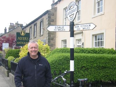
A late morning meet up in the village of Gargrave after a very tasty bacon
sandwich in the famous Dalesman Cafe for Andy, followed by a quick visit
for a takeaway sandwich from the Co-op in the main street for Peter.
This was agreed as a very short Pennine Way walk to take us just four and a half miles miles
north to Airton. All very well until we saw the Gargrave Pennine Way sign
- Edale 70 miles , Kirk Yetholm 168 miles - and realised just how little we were biting off!
|
|
|
Still, after the usual routine of getting the cars to the right places
we left Gargrave on a lane that soon became a track and then steadily
North West through some of the loveliest rolling countryside you could
imagine. And with a bright, warmish morning, altogether a far cry from Kinder Scout in October.
|
|
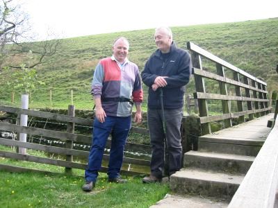
Having not met up for six months we were a little distracted from the wonderful
scenery by catching up on news of family and work but the easy and straightforward
route almost looked after itself. Before we knew it we hit the footbridge
over the Aire just short of Newfield Hall and within a further short distance
we saw Airton ahead of us, just 3 miles south of Malham.
|
|
|
Peter by now looking disappointed that the walk is coming to an end;
Andy glad to be stopping as walking any distance leading to pain in
the left foot (hence the reason for the short distance!)
Up from the Pennine Way (after checking parking for the next section) and
past the well converted and very nicely positioned mill, into the Land
Rover and onto the next part of the weekend - a good few pints of Timothy
Taylor Landlord in Ripon!
|
|
| Day 4. Airton to Malham. 15 August 2009 |
| | |
|
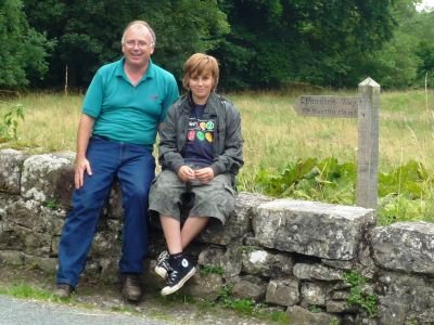
Back in Airton two years later. No Andy this time. After Day 3 it was
clear that Andy wouldn't be completing the whole walk, so in the meantime
we've been meeting up in the Lake District for some low-level walking
and evenings in the pub. (To be honest, the older we get the more we seem
to focus on the choice of pubs and restaurants for the evening, rather
than the walk). But I'm is not ready to give up on the Pennine Way project
just yet, so, together with younger son Jonathan, set off for Malham,
following the course of the River Aire to its source.
|
|
|
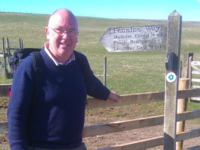
It's just a couple of easy miles to Malham, with
a short climb up the hill at Hanlith marking
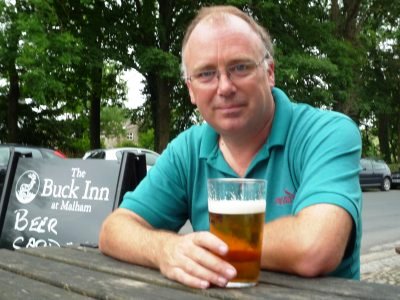
the half way point. We arrive at the Buck Inn in time for a quick drink
and a game of pool before getting the bus back to the car. Then back
to Malham to pitch the tent at Riverside camp site, before heading off
to the cinema in Skipton to see 'The Taking of Pelham 123'.
|
|
| Day 5. Malham to Malham Tarn 16 August 2009 |
|
|
|
|
We wake to heavy clouds and light drizzle, and this turns out to be the
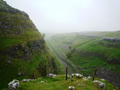
best weather of the day. It's just a short walk up the hill to Malham
Cove - an 80 metre curved crag formed by melt water after the last ice
age. The waterfall has long since gone but the Cove is still a magnificent
site. The route takes you steeply up to the left to the 'clints' and
'grykes' of the limestone pavement at the top, then north through 'Dry
Valley', which today fails to live up to its name.
|
|
|
By the time we reach Malham Tarn we're soaked, and decide to call it a day. We retrace
our route to the camp site, rather than completing the circular walk we'd
planned, and so miss out on Gordale Scar and Janet's Foss. Jonathan has
a shower and gets dry but I need to walk to the Buck Inn and back first,
so as not to leave a half-mile gap in this otherwise completed section
of the Pennine Way. (Well, you'd do the same, wouldn't you?)
|
|
| Day 11. Malham Tarn to Horton in Ribblesdale 23 April 2016 |
|
|
|
|
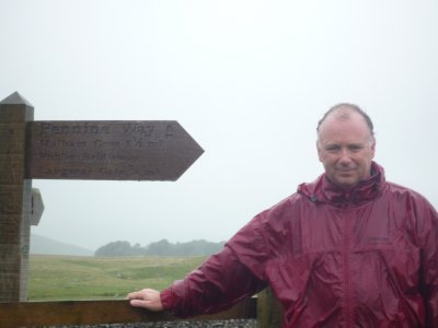
Back again seven years on. I've put on a little more weight and lost a little
more hair, but at least it's stopped raining. There's a gentle walk around
the east side of Malham Tarn before heading north.
|
|
|
Fountains Fell is only about 30 metres below the summit of Pen-y-Ghent so it's
quite a climb, but wonderful views from the top.
|
|
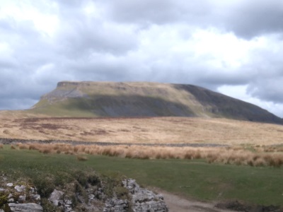
Dropping down into the valley there are good views of the main event for this
section of the walk. There's a about a mile of road walking south
east before doubling back and tackling Pen-y-Ghent's steep south side.
This is actually the lowest of the Three Peaks, but it doesn't feel like
it as you reach the summit. There's a gentler descent down to Horton in
Ribblesdale. I've just missed a train, so there's a bit of a wait and
it's after 6:00 p.m. when I arrive in Skipton to meet Andy for dinner and
a few pints
|
|
|
|